 By the NAXTECH team · Published 22 Oct 2026 · Updated 5 Nov 2026 · Hands-on with v2.0
Your battery is down to two bars, you pull into a charging bay you found on a generic map, and the only connector on the post is one your car cannot take. Anyone who drives an EV in Thailand knows that sinking feeling: plenty of pins, no way to know which ones will actually charge your car — and no signal to check. สถานีชาร์จรถไฟฟ้า was built to answer the only question that matters at that moment: where is the nearest charger my car can plug into, and how do I get there?
It is a dedicated EV charging map for Thailand. You tell the app which connectors your car uses once, and from then on the map filters itself to stations that can really charge you. Because the station data is bundled into the app, the search keeps working when the mobile signal does not.
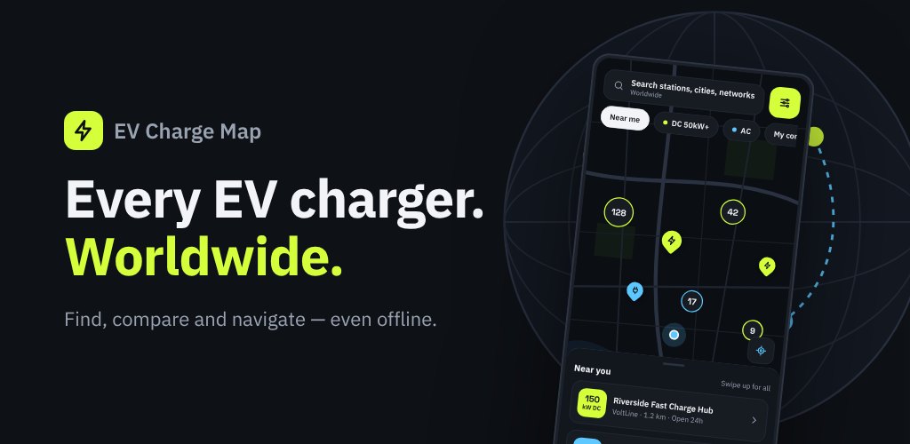
The home screen is a live OpenStreetMap map with clustered station markers, so a dense city like Bangkok stays readable and a quiet highway still shows every option. A search bar looks up stations, cities and charging networks, and quick filter chips cut the map down in one tap: Near me, DC 50kW+ for fast charging, AC, and My connectors to hide everything your car cannot use. A "near you" sheet swipes up to list the closest stations with their distance from you.
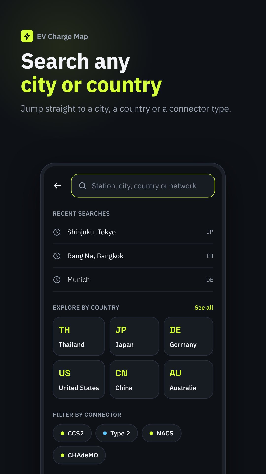
EV connectors are a mess of standards, and the app treats that head-on. It knows CCS2 and Type 2 (the DC and AC standards common across Europe and Asia, including Thailand), plus NACS, CCS1, CHAdeMO (DC, Japan) and GB/T (DC/AC, China). Each station card shows which plugs are on site, how many ports of each, and flags the ones that fit your car, so you are never guessing from an ambiguous icon.
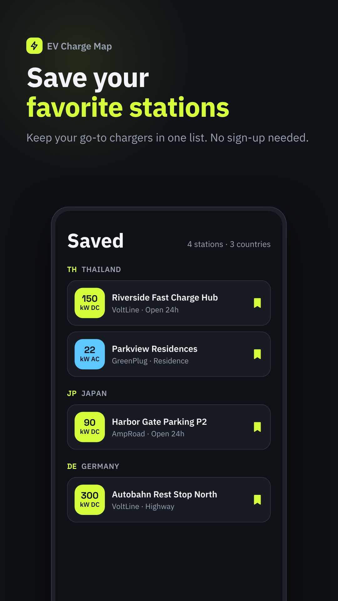
The stations you need most are often on a rural highway with one bar of signal. สถานีชาร์จรถไฟฟ้า ships station data inside the app and lets you manage offline map packs by country, showing how much storage each uses and when an update is available. Your Saved stations, the search and the station details all keep working with no connection — exactly when you need them.
Set your preferred distance unit (km or miles) and currency so prices and distances read the way you expect, and switch the interface between ten languages — Thai, English, Japanese, Chinese, Korean, German, French, Spanish, Indonesian and Vietnamese — which makes it as usable for visitors renting an EV as for locals.
Location access is optional and only used to show nearby stations and your distance from them; you can browse the whole map without it. Pricing and hours come from a community database and can change, which is why the in-app Report wrong info button exists. The app is free and supported by ads.
Yes. Station data is built into the app and you can keep offline map packs, so search, saved stations and station details work with no signal.
Set your connectors under Settings → My car, then tap the "My connectors" filter on the map to hide any station your vehicle cannot plug into.
Yes. Each station has a Navigate button that hands off to Google Maps for turn-by-turn directions, and you can copy or share the address too.
Yes, it is free to download and is supported by ads; no account is required to use it.
Get สถานีชาร์จรถไฟฟ้า on Google Play →
โดย ทีม NAXTECH · เผยแพร่ 20 ต.ค. 2569 · อัปเดต 29 ต.ค. 2569 · ทดลองใช้เวอร์ชัน 2.0
แบตเตอรี่เหลือสองขีด คุณเลี้ยวเข้าจุดชาร์จที่เจอในแผนที่ทั่วไป แต่หัวชาร์จบนตู้กลับไม่ตรงกับรถของคุณเลย คนขับ EV ในไทยรู้ดีถึงความรู้สึกใจหายแบบนี้ — มีหมุดเต็มแผนที่ แต่ไม่รู้เลยว่าตู้ไหนชาร์จรถเราได้จริง แถมบางทีก็ไม่มีสัญญาณให้เช็ก แอปสถานีชาร์จรถไฟฟ้าถูกสร้างมาเพื่อตอบคำถามเดียวที่สำคัญที่สุดในวินาทีนั้น คือ ตู้ชาร์จที่รถเราเสียบได้ที่ใกล้ที่สุดอยู่ตรงไหน แล้วไปยังไง
นี่คือ แผนที่สถานีชาร์จ EV สำหรับประเทศไทยโดยเฉพาะ เพียงเลือกหัวชาร์จที่รถคุณใช้ไว้ครั้งเดียว จากนั้นแผนที่จะกรองให้เหลือเฉพาะสถานีที่ชาร์จรถคุณได้จริง และเพราะข้อมูลสถานีถูกฝังมาในแอป การค้นหาจึงยังทำงานได้แม้สัญญาณมือถือจะหายไป
หน้าแรกเป็นแผนที่ OpenStreetMap ที่รวมกลุ่มหมุดสถานี (clustering) ทำให้เมืองหนาแน่นอย่างกรุงเทพฯ ยังดูง่าย ส่วนทางหลวงที่สถานีน้อยก็เห็นครบทุกจุด มีช่องค้นหาสถานี เมือง และเครือข่ายผู้ให้บริการ พร้อมชิปตัวกรองที่ตัดแผนที่ให้แคบลงในแตะเดียว ได้แก่ ใกล้ฉัน, DC 50kW+ สำหรับชาร์จเร็ว, AC และ หัวของรถฉัน เพื่อซ่อนทุกสถานีที่รถคุณเสียบไม่ได้ แผ่นรายการ "ใกล้คุณ" ปัดขึ้นเพื่อดูสถานีที่ใกล้ที่สุดพร้อมระยะทางจากตำแหน่งของคุณ
มาตรฐานหัวชาร์จ EV นั้นหลากหลายและสับสน แอปนี้จึงจัดการให้ตรง ๆ โดยรู้จักทั้ง CCS2 และ Type 2 (มาตรฐาน DC และ AC ที่ใช้กันทั่วยุโรปและเอเชียรวมถึงไทย) พร้อมด้วย NACS, CCS1, CHAdeMO (DC ญี่ปุ่น) และ GB/T (DC/AC จีน) การ์ดของแต่ละสถานีจะบอกว่ามีหัวชาร์จอะไรบ้าง แต่ละแบบมีกี่หัว และไฮไลต์หัวที่ ตรงกับรถคุณ ให้ชัด คุณจึงไม่ต้องเดาจากไอคอนที่กำกวมอีกต่อไป
สถานีที่เราต้องการมากที่สุดมักอยู่บนทางหลวงต่างจังหวัดที่สัญญาณเหลือขีดเดียว แอปสถานีชาร์จรถไฟฟ้าจึงฝังข้อมูลสถานีไว้ในตัวแอป และให้จัดการ แผนที่ออฟไลน์เป็นรายประเทศ โดยบอกว่าแต่ละชุดใช้พื้นที่เท่าไร และเมื่อใดที่มีอัปเดตใหม่ สถานีที่บันทึกไว้ การค้นหา และรายละเอียดสถานีทั้งหมดยังทำงานได้แม้ไม่มีการเชื่อมต่อ — พอดีกับตอนที่คุณต้องใช้มันจริง ๆ
ตั้ง หน่วยระยะทาง (กม. หรือไมล์) และ สกุลเงิน ที่คุณต้องการ เพื่อให้ราคาและระยะทางแสดงอย่างที่คุ้นเคย อินเทอร์เฟซรองรับถึงสิบภาษา — ไทย อังกฤษ ญี่ปุ่น จีน เกาหลี เยอรมัน ฝรั่งเศส สเปน อินโดนีเซีย และเวียดนาม — ทำให้ทั้งนักท่องเที่ยวที่เช่ารถ EV ในไทยและคนไทยใช้งานได้สะดวกเท่ากัน
การเข้าถึงตำแหน่งเป็นทางเลือก ใช้เพียงเพื่อแสดงสถานีใกล้คุณและระยะทางจากคุณเท่านั้น คุณเปิดดูทั้งแผนที่ได้โดยไม่ต้องให้สิทธิ์ ข้อมูลสถานีอย่างราคาและเวลาเปิดมาจากฐานข้อมูลของชุมชนและอาจเปลี่ยนแปลงได้ จึงมีปุ่ม แจ้งข้อมูลไม่ถูกต้อง ในแอป ตัวแอปใช้งานฟรีและมีโฆษณาสนับสนุน
ได้ ข้อมูลสถานีอยู่ในแอปและเก็บแผนที่ออฟไลน์ได้ ดังนั้นการค้นหา สถานีที่บันทึก และรายละเอียดสถานีจึงทำงานได้แม้ไม่มีสัญญาณ
ตั้งหัวชาร์จของคุณที่ ตั้งค่า → รถของฉัน แล้วแตะตัวกรอง "หัวของรถฉัน" บนแผนที่ เพื่อซ่อนสถานีที่รถคุณเสียบไม่ได้
ได้ แต่ละสถานีมีปุ่มเริ่มนำทางที่ส่งต่อไป Google Maps เพื่อนำทางแบบเลี้ยวต่อเลี้ยว และยังคัดลอกหรือแชร์ที่อยู่ได้ด้วย
ฟรี ดาวน์โหลดได้โดยไม่มีค่าใช้จ่าย มีโฆษณาสนับสนุน และไม่ต้องสมัครสมาชิกเพื่อใช้งาน