 By the NAXTECH team · Published 3 Nov 2026 · Updated 6 Nov 2026 · Hands-on with v2.0

You step off the cable car at 1,487 metres, the cloud rolls in, the Golden Bridge is somewhere to your left — and your phone has one bar of signal that keeps dropping. Ba Na Hills is a sprawling French-village resort stacked up a mountain, and the one moment you need a map and a plan is the moment the network gives up. Banahills Danang was built for exactly that moment.
It is an offline visitor guide: the illustrated park map, every place, the opening hours and the day plans are bundled inside the app, so nothing waits for a signal once you are on the summit. Open it on the bus, lose connection in the gondola, and the guide still works at the top.
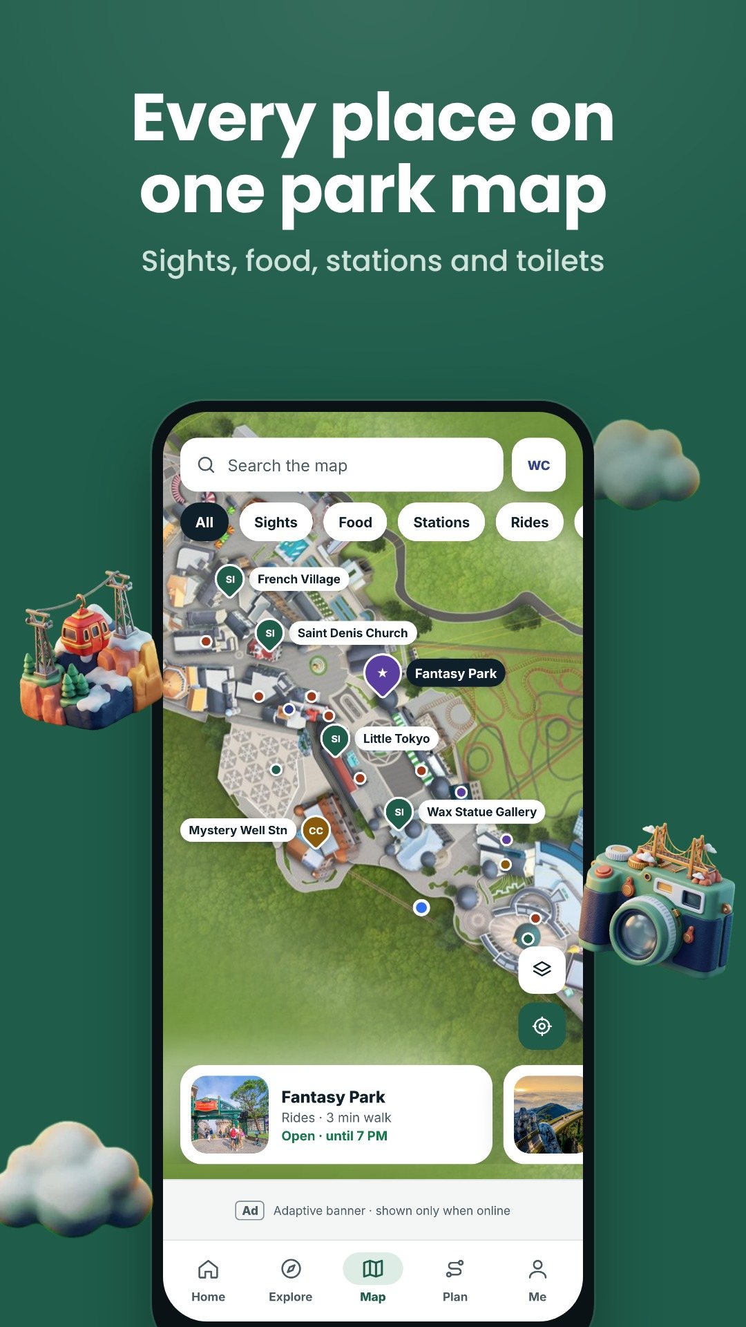
The map is a single hand-drawn layer of the park — no map tiles, no network calls. You pan and pinch across the Peak and Mountain-foot areas, filter the pins by category — sights, food and drink, cable stations, rides, pagodas, hotels, shopping and facilities — and tap any place to read it. Grant location once and a blue dot shows where you are standing against the illustration, with a day-route mode that threads your chosen stops into a walking line.
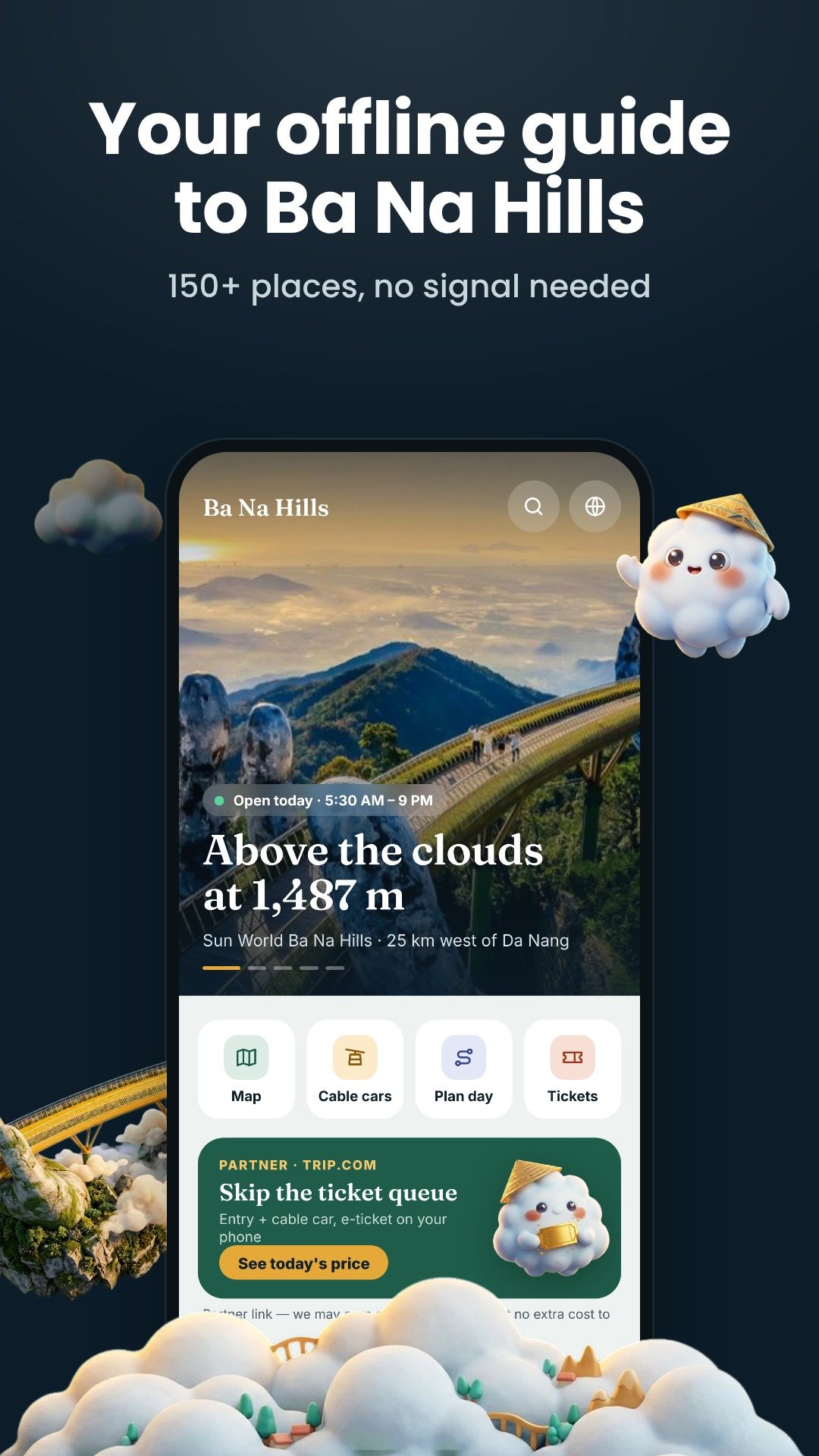
Getting up and down the mountain means picking the right cable car, and the app lays out all four lines with the facts, not guesses. The record-holding Toc Tien – L'Indochine line runs 5,772 m with 86 cabins on 25 towers; Suoi Mo – Ba Na is the original 2009 line at 5,043 m; Hoi An – Marseille (5,261 m, opened 2017) carries up to 2,000 people an hour; and Champa – Taiga (5,864 m, opened 2021) tops out at 3,000. Each line shows its two end stations, length, cabin and tower count, hourly capacity and opening year, so you can choose the quickest way to the Golden Bridge.
The planner ships ready-made itineraries with timed stops. The free Classic full day walks you from Marseille Station to the Golden Bridge for early photos, then Le Jardin d'Amour, Linh Ung Pagoda, the Debay Wine Cellar and lunch before Fantasy Park; a Half-day plan trims it to about four hours. Plus unlocks a kid-friendly route through the Alpine Coaster and the wax gallery, and a sunset plan that ends at the bridge for golden hour. Every stop carries the time and a one-line note on what to do there.
The built-in passport holds eight collectible stamps — the Golden Bridge, French Village, Linh Ung Pagoda, the Debay Wine Cellar, Fantasy Park, Le Jardin d'Amour and the summit. You earn a stamp by physically standing within about 50 metres of the place and checking in, you climb five explorer ranks as the book fills, and you can render the finished passport to an image and share it.
A facilities finder points you to the nearest toilets, ATM, information desk, prayer room, baggage store, ticket counter and parking. A gallery and search let you dig through more than 150 places, each with photos, hours, phone and address. When you are ready to buy, the Tickets tab opens partner offers — park entry, airport transfers, hotels, tours and a travel eSIM — in your browser.
The guide, map and place data are offline; booking links, photos loaded from the web and the partner offers need a connection. Opening hours, prices and timetables are those published for the resort and can change, so treat them as a guide rather than a guarantee. The app is free with ads, and an optional Plus upgrade — a lifetime unlock or a 30-day pass — removes ads and opens the premium plans and passport frames.
Yes. The illustrated map, the 150-plus places, opening hours and the day plans are bundled in the app, so they work on the summit with no signal. Only booking links and web photos need a connection.
No. It is an independent visitor guide made by the NAXTECH team to help you find your way and plan the day; tickets are handled through partner links.
The app lists all four lines with length, capacity and stations so you can compare; the Hoi An – Marseille and Champa – Taiga lines carry the most people per hour.
Yes, it is free to download with ads, and offers an optional Plus upgrade — a lifetime unlock or a 30-day pass — that removes ads and adds the premium plans.
Get Banahills Danang on Google Play →
 By the NAXTECH team · Published 1 Aug 2026 · Updated 26 Oct 2026 · Hands-on with v2.0

You are through the gate, the kids are pulling toward the first enclosure, and somewhere across the park a dolphin show starts in eleven minutes — but you have no idea where, or whether you can make it. That is the moment Safari World Guide was built for: an unofficial, offline companion to Safari World Bangkok that answers the only question that matters on the day — what is on next, and can we get there? Everything lives on your phone, so a tap at the far end of the Safari Park never waits for a signal the jungle will not give you.
Open the app and the Today tab shows the live status of both parks — whether the Safari Park and Marine Park are open right now, on the correct weekday or weekend timetable. Below it, a "Later today" strip lists the next shows in order, flags any two that clash at the same minute, and points you at the nearest animal you have not stamped yet with the walking time to reach it.
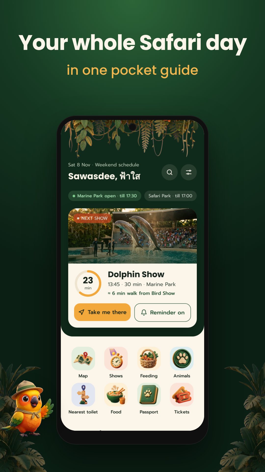
The Shows tab is a full day timeline of all seven shows — three in the Safari Park, two marine and two action shows — each with its weekday and weekend start times and how long it runs (the Orang Utan Show is a 25-minute slot). A live line marks "now", so you see at a glance what has passed and what is coming. Tap the bell on any show and the app sets a local reminder a few minutes before it starts, with the time and venue, so it reaches you with the phone in your pocket and the data off.
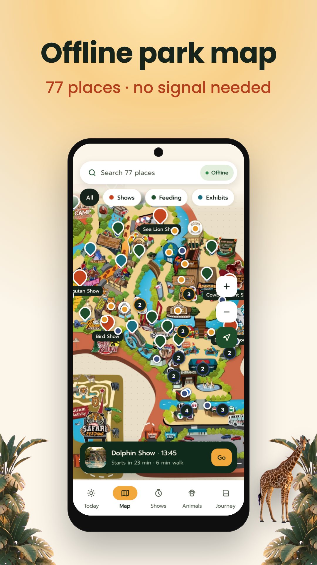
The Map is a hand-illustrated plan of the whole park with 77 points of interest — show arenas, feeding spots, exhibits, restaurants and cafés, toilets, ATMs, first aid and more — that cluster as you zoom so the labels never pile up, with your live GPS dot on top. When you need something fast, the Nearest finder sorts the closest toilet, food, first aid, ATM, information point or prayer room by walking distance from where you stand (or from the entrance if there is no fix yet).
Tap My Day and the planner builds a route for you: it fits in as many shows as it can with no clashes, drops in walking time between stops and adds lunch and feeding breaks. Choose the pace that suits your group — Must-see, Relaxed or Kids — and set reminders for the whole plan in one tap.
Safari World Guide turns the visit into a game. The Safari Passport holds 20 stamps — one for each of the 13 star animals and 7 shows. Collected stamps sit in full colour at a cheerful tilt; the ones you have not earned are a dashed ring with a faded silhouette, exactly the nudge a child needs to find the next one. Each animal has its own page with the scientific name, habitat and whether it is a show star, a must-visit or a rare sighting.
The Journey tab is a travel journal. Add a memory, attach a photo from your camera, and the app suggests the place from your offline GPS position — no typing a location you cannot name. At the end of the day, build a day recap: a 9:16 story card with your stamps, the shows you saw and your best photo, in a jungle, polaroid or golden frame, ready to share.
Safari World Guide is an independent, unofficial companion and is not affiliated with the park. Live location and the nearest-facility finder use your phone's GPS, which you can decline and still use everything else. The app is free with ads; the optional Explorer Pass removes them and unlocks the golden recap frame. Ticket links are affiliate links that help keep the guide free.
Yes. The map, show times, animal pages, planner and passport all run offline, so you can use them inside the park with mobile data switched off.
Yes. Tap the bell on any show and it sets a local notification that fires a few minutes before, with the start time and the venue.
No. It is an independent, unofficial visitor guide and is not affiliated with Safari World.
Eight: English, Thai, Chinese, Japanese, Korean, Hindi, Russian and Vietnamese.